New Popular Mapping - Map GPX Tracerbeta
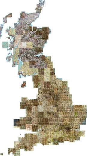
Have a look round what the country looked like in the 1940s. Click on the map to the right to start, you can then scroll around and zoom in.
Whilst looking around, you can switch into another mode to trace a GPX trace from the map. You can then take this GPX trace, and import it into other systems (such as OpenStreetMap or Google Earth).
Why not trace out the course of an old railway, and see its route on google earth? How about tracing the old outskirts of your town, and see how it has grown?
As our scans of the old maps aren't perfectly aligned, you should calibrate the tracing program before you start tracing your GPX trace. See the tracing page for details on how to do this.
This is a sister project of http://npemap.org.uk/. Please see the Licence Page on what you can and can't do with the tiles, and traces you make from them.
If you have any thoughts, problems, ideas etc, please get in touch at gpx@npemap.org.uk.
Click on the map to zoom in and get on with it.